Warehousing and Distribution in Washington State
✨ This article was AI edited. Editorial responsibility: The Future Warehouse.
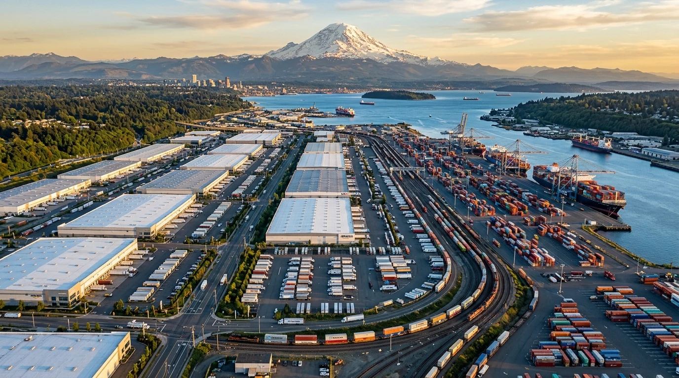
Positioned as the northernmost logistics terminus on the United States West Coast, Washington State occupies an irreplaceable strategic position in global and domestic supply chain architecture. Serving as the closest major American deepwater port complex to key East Asian manufacturing centers—providing a two-to-three-day sailing time advantage over the Ports of Los Angeles and Long Beach—Washington has evolved into a premier destination for transloading, third-party logistics (3PL) warehousing, cold chain agricultural exports, and high-velocity e-commerce fulfillment.
Key Industrial Logistics Submarkets in Washington State
Industrial warehousing in Washington is geographically concentrated along critical highway arteries, deepwater ports, and inland intermodal rail hubs. Supply chain operators divide the state into five distinct logistics submarkets:
- Kent Valley / South King County: The historical industrial core of the Pacific Northwest. Located midway between Seattle and Tacoma along State Route 167 and Interstate 5, the Kent Valley houses over 80 million square feet of distribution space, serving local urban consumption and port container drayage.
- Pierce County / Tacoma & Puyallup: The primary destination for large-footprint modern logistics campuses (500,000+ sq. ft.). Driven by competitive land costs and direct rail connectivity to the Port of Tacoma terminals, submarkets like Frederickson, Sumner, and Fife handle heavy import transload and retail distribution.
- Thurston & Lewis Counties (Lacey, Centralia, Chehalis): The southern I-5 corridor serving as an ideal mid-point replenishment depot between the Seattle-Tacoma metropolitan area and the Portland, Oregon market. Major national retailers maintain mega-fulfillment centers here to service both states simultaneously.
- Snohomish County / North Sound (Arlington, Marysville): Emerged as a critical aerospace manufacturing and advanced e-commerce distribution hub along the I-5 North corridor, connecting Puget Sound logistics to the Canadian border at Blaine / Vancouver, BC.
- Inland Empire / Spokane & Columbia Basin: Eastern Washington represents a specialized logistics ecosystem. Anchored by the Spokane International Airport rail-intermodal hub and vast agricultural cold storage facilities in Yakima, Tri-Cities, and Moses Lake, this submarket dominates outbound agricultural exports and regional distribution across the Mountain West.
Intermodal Infrastructure: Ports, Class I Rail, and Interstate Arteries
The efficiency of Washington’s distribution network depends upon the tight physical integration between maritime docks, transcontinental railroads, and interstate highways:
1. The Northwest Seaport Alliance (NWSA)
Formed as a joint marine cargo operating alliance between the Ports of Seattle and Tacoma, the NWSA is the fourth-largest container gateway in North America. Marine terminals feature deepwater berths capable of handling ultra-large container vessels (ULCVs) of 18,000+ TEU, offering on-dock rail yards that eliminate highway drayage by loading international containers directly onto outbound railcars.
2. Transcontinental Freight Rail Corridors
Both BNSF Railway and Union Pacific Railroad operate extensive mainlines traversing Washington. BNSF’s Northern Corridor carries double-stack intermodal container trains eastward across the Cascade Mountains through Stevens Pass and Stampede Pass, reaching Chicago and Midwest distribution hubs within four to five days.
3. Critical Highway Transport Corridors
Highway freight relies on two primary axes:
- Interstate 5 (North-South): Connects the Canadian border at British Columbia southward through Seattle, Portland, California, and Mexico.
- Interstate 90 (East-West): The nation’s longest interstate highway commences in Seattle and cuts east across Snoqualmie Pass, providing vital all-weather heavy freight transit to Spokane, the upper Midwest, and Chicago.
- Interstate 82: Diverges from I-90 at Ellensburg, serving the agricultural and freight processing centers of Yakima and the Tri-Cities before joining I-84 into Idaho and Utah.
Comparative Analysis: Washington Logistics Submarket Metrics
The operational specifications, typical clear heights, and freight specialization of Washington’s key warehousing clusters are outlined in the matrix below:
| Logistics Submarket | Average Clear Heights | Primary Freight Category | Primary Highway / Rail Access | Strategic Purpose |
|---|---|---|---|---|
| Kent Valley | 24′ – 32′ (Infill / Mature) | Urban Delivery, Aerospace, Food & Beverage | SR-167, I-5, I-405, BNSF/UP | Same-day metro last-mile replenishment |
| Pierce County / Tacoma | 36′ – 40′ (Modern Big-Box) | Import Transload, E-Commerce, Retail Goods | I-5, SR-512, Port of Tacoma On-Dock Rail | High-throughput import cross-docking |
| Lacey / Centralia Corridor | 36′ – 42′ (Modern Campus) | Regional Retail Replenishment, Heavy Goods | Interstate 5 (Central Corridor) | Dual-state Washington + Oregon distribution |
| Spokane / Inland Northwest | 32′ – 36′ (Cross-Dock & Cold) | Agricultural Exports, Regional 3PL, Parcel | I-90, US-395, Spokane Int’l Airport Rail | Inland Empire & Intermountain logistics hub |
Cold Chain Logistics and Washington’s Agricultural Export Economy
A distinctive dimension of Washington’s distribution landscape is its temperature-controlled infrastructure. Washington is the nation’s leading producer of apples, sweet cherries, pears, hops, and concord grapes, generating billions in outbound agricultural trade. Controlled-atmosphere (CA) and blast-freezing cold storage facilities across the Yakima Valley and Wenatchee preserve produce for year-round export.
Refrigerated freight moves via specialized domestic reefer truck fleets and temperature-controlled intermodal railcars to coastal terminals, where reefer plugs on container vessels keep commodities fresh during oceanic transit to Japan, South Korea, Taiwan, and Southeast Asia.
Navigating Regulatory and Environmental Frameworks
Logistics operators developing or leasing warehouse space in Washington must navigate progressive statewide environmental guidelines, including the Climate Commitment Act (CCA) and Clean Buildings Performance Standards. Leading distribution facilities across King and Pierce counties integrate rooftop solar generation, advanced stormwater filtration basins to protect salmon-bearing waterways, and electrical infrastructure engineered to support medium-and-heavy-duty electric vehicle (EV) commercial yard hostlers and delivery fleets.
To examine how regional distribution architecture compares with nationwide corporate networks, review our analyses of Amazon Prime distribution facilities and Walmart warehouse alignment strategies.
Frequently Asked Questions Regarding Washington State Warehousing
Why is Washington State considered an advantageous import gateway compared to Southern California?
Vessels sailing from major East Asian manufacturing ports to the Northwest Seaport Alliance (Seattle/Tacoma) enjoy a sailing distance that is up to 1,000 nautical miles shorter than routes to Los Angeles/Long Beach, saving carriers 2 to 3 days of transit time and significant fuel costs.
What is the primary warehousing submarket for large-footprint e-commerce fulfillment in Washington?
Pierce County (including Tacoma, Sumner, and Frederickson) and the Southern I-5 corridor (Lacey, Centralia) are the primary submarkets for modern large-footprint fulfillment centers exceeding 500,000 square feet, offering 36-to-40-foot clear heights and direct interstate access.
How does winter weather across the Cascade Mountain passes affect East-West distribution?
Heavy snowfall on Snoqualmie Pass (I-90) and Stevens Pass (US-2) can occasionally cause temporary commercial truck chain requirements or pass closures. Logistics operators rely on real-time WSDOT mountain pass reports and transcontinental rail corridors (BNSF/UP) to maintain supply continuity during severe winter storms.
Get our latest guides, news, and insights highlighted in your Google Search & AI Overviews.